The UH Coastal Center is within the city limits of La Marque, Texas, in Galveston County, about 15 miles north of Galveston. Visitors enter the property from FM 2004.
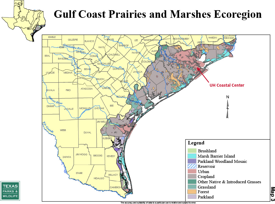
The UHCC contains a significant sample of remaining coastal prairie, but how does it fit into a map of ecoregions? UHCC is within the Gulf Coast Prairies and Marshes Ecoregion of Texas.
However, most of the coastal prairie that once existed there no longer exists, which is why remaining high-quality coastal prairie, such as that at UHCC, is so valuable and why coastal prairie restoration is such an important goal. Of the estimated 6.5 million acres of coastal prairie originally within Texas, less than 1% remains.
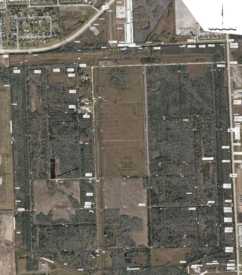
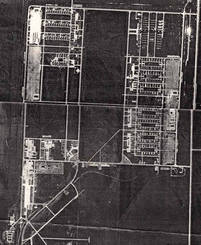
If you examine an aerial survey of UHCC, you quickly notice that the roads are laid out on a grid, oriented north-south and east-west. There are two dominant colors—light brown and patchy green. The light brown areas largely conform to units of coastal prairie while the patchy green areas are invasive woody brush. In particular, there is a prominent light brown rectangular area in the middle. That particular rectangle, known as the Aumann Prairie, is approximately 100 acres and represents pristine coastal prairie that has never been plowed. The geometry of the roads and land units at UHCC dates from 1940 when Camp Wallace was constructed on what had been coastal prairie.
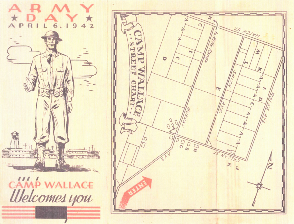
A brochure welcoming visitors to Camp Wallace on Army Day on April 6, 1942 (about four months after the United States entered World War II), contains a street map. Again, we see that distinctive rectangle marked with the letter “E.” The “E” marks the Parade Ground of Camp Wallace—now the Aumann Prairie. It is quite clear from the brochure that the roads were aligned with a compass. Today, when you visit UHCC, you can always tell which way is north. If you stand on any road around the perimeter of the Aumann Prairie and face I-45, you are facing north.
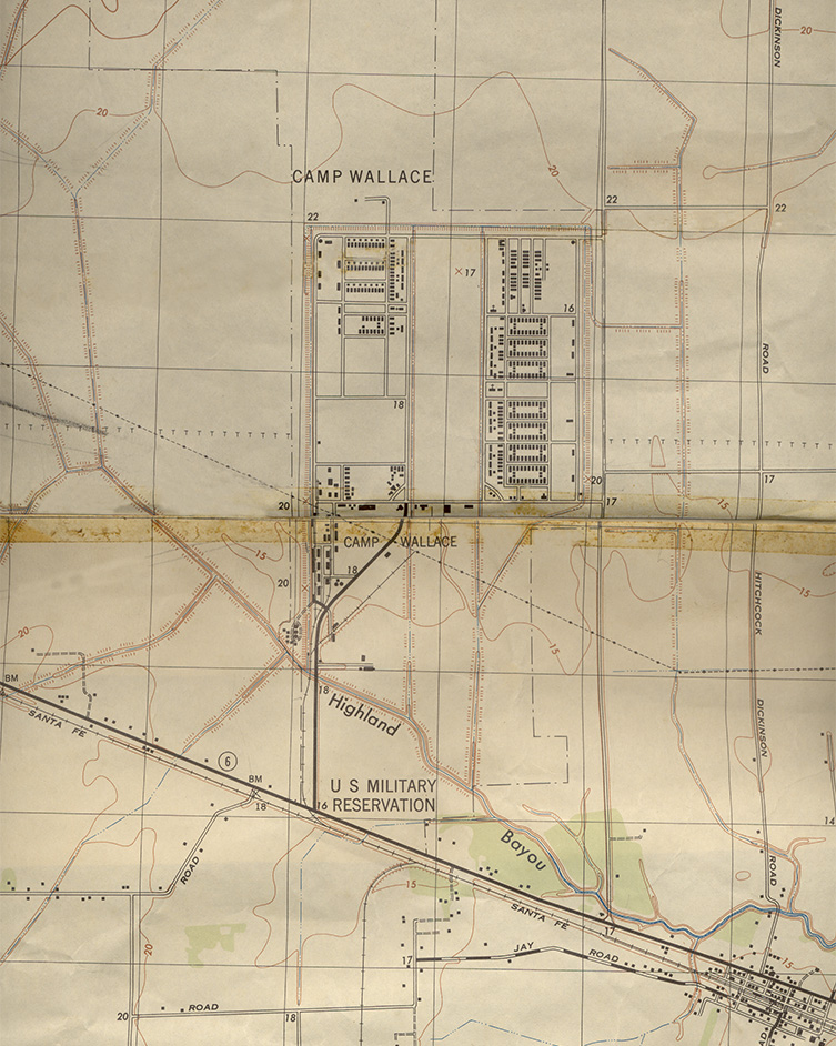
But a simple Camp Wallace street map, while it confirms that the current road system at UHCC is the same as in the 1940s, is not useful in planning prairie restoration. However, a detailed map from 1945 helps us determine exactly where the Camp Wallace structures were located and where there were no structures at all.
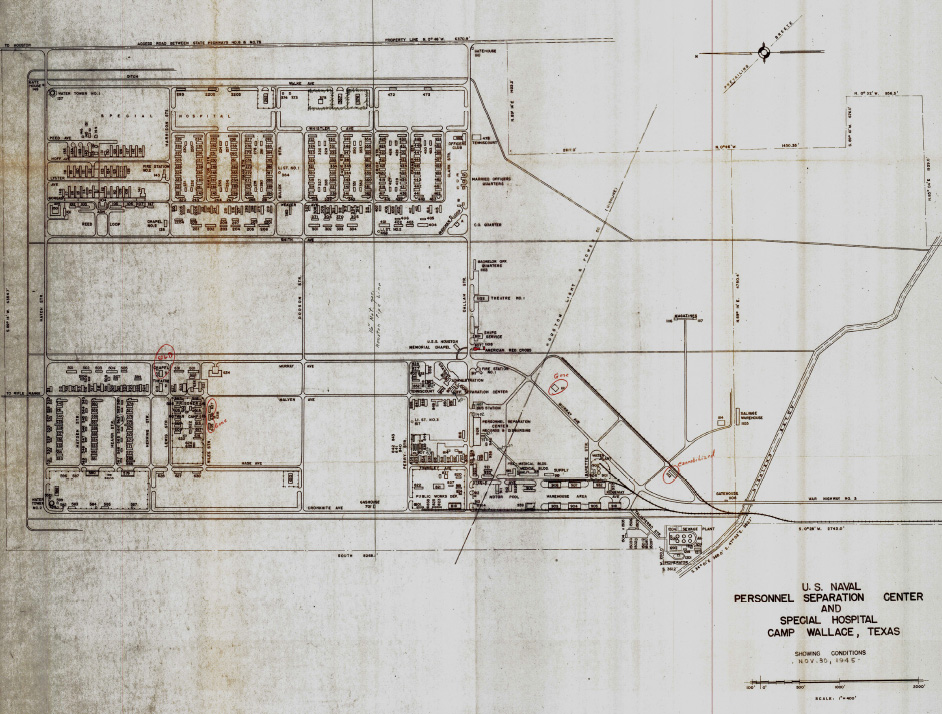
Although the 1945 Camp Wallace map is shown greatly reduced in size, the original map is large enough to see that every structure is numbered and corresponds to a key. Again, the distinctive rectangle corresponding to the Aumann Prairie confirms that there were no buildings constructed there. This building map—when correlated to the UHCC road system, which is the same as shown on the map—allows us to identify what were open areas and which areas should be easier to initiate prairie restoration. However, when we look at the historic map and see comparatively dense areas of barracks, it is important to remember that most of the Camp Wallace buildings were built of wood and constructed on piers, i.e., no concrete slabs. Once the buildings were removed, the earth was exposed again.
However, we cannot assume that “No Structures equals No Disturbance.” When the road system of Camp Wallace was constructed, oyster shell was the construction material of choice. Not only roads, but also maintenance and parking areas were constructed of oyster shell.
When prioritizing candidates for restoration, we have to compare the 1945 building map with an aerial photo. The white patches on the aerial photo represent areas that are covered by oyster shell. Those areas would be the most difficult to restore. By examining the historical maps, we can determine the likely substrate, even if it is now covered in brush, and prioritize our restoration efforts accordingly.
A topographic map from the Camp Wallace era helps us better understand the flow of water across the landscape. Camp Wallace’s close proximity to Highland Bayou certainly explains why the site flooded during a heavy rain when construction first began and why our coastal prairie today can be such a wet prairie.
Collating information from multiple maps not only allows UHCC to prioritize its current restoration efforts, but also helps us identify part of the history of the Camp Wallace site. We have identified foundational remains of some of the Camp Wallace buildings in cooperation with the Santa Fe Area Historical Foundation and consider them an integral part of the UHCC story.